THE QUESTION OF TAIWAN
ANSWERED WITH FACTS
OF PHYSICAL OCEANOGRAPHY
We start with a comment about the psychology of nations.
On a highway to the Duesseldorf Airport, in the far western part of present-day Germany, there’s a large granite rock with one word inscribed thrice: “Danzig Danzig Danzig.” The words refer to the widely-supposed reason for marching into Poland on 1 September 1939: access to Danzig, now called Gdansk, blocked by the 1919 Treaty of Versailles. The real reason for marching into then-Poland was a 1939 Non-Aggression Pact between then-Germany and then-Russia. When this real reason was acted on, and the Germans did their part of the deal with the Russians, the Germans were surprised to learn that Britain and France felt obliged to declare war. Why? There was only a deal made between two European Powers, very similar to such deals made in prior centuries. Why should other European Powers care? So began a nine-month pause in history, called a Phony War, as Germany prepared a response. The response, we all know, was an historical disaster.
Something like such complaining goes on now with Taiwan. A deal was made in 1949, after Mao’s Communist Party took over all of then-mainland China, to allow Taiwan to remain under the rule of the ousted political party, separate. The mainland has 1.4 billion people, and it has just sent three astronauts into space, and it’s about to become the biggest economic power in the world, but it’s shouting “Taiwan Taiwan Taiwan.” Why?
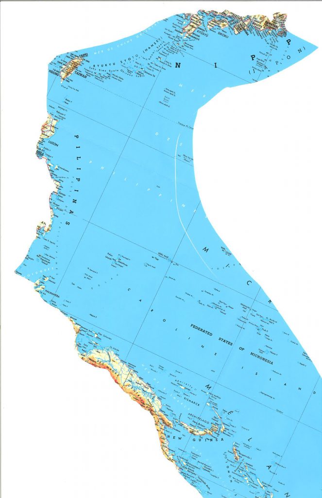
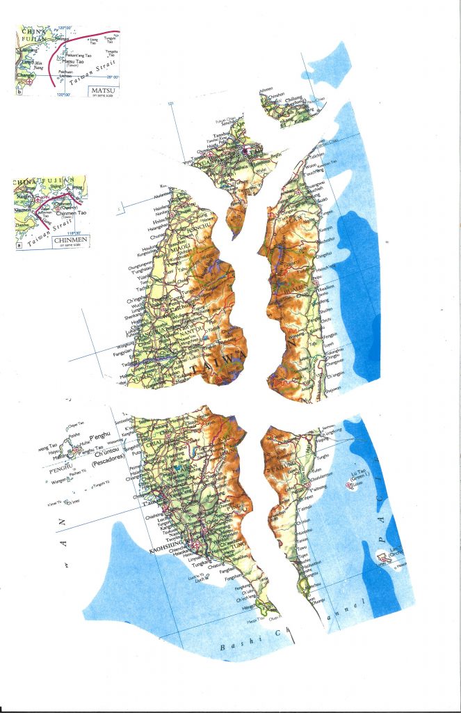
In scientific fact, even more than with a city on Baltic Sea named Danzig, now named Gdansk, the territory of Taiwan, except for some tiny islands within sight of China called Quemoy and Matsu, has nothing physically to do with mainland China. Taiwan is surrounded on all sides by a major ocean current, the Kuroshio, or “black current”, which never touches mainland China. Oceanographically, Taiwan andmainland China have no connection. They have very different biota,with waters and fish coming from a very different part of the Pacific,a part unrelated to the South China Sea or East China Sea, or any other Sea into which mainland China drains, so, why the fuss?
Civil-satellite data, such as AVHRR data showing sea-surface temperature, make clear that the entire Taiwan island lies insidea warm-water stream extending from Palau and the eastern Philippines to southern Japan, then flowing onward to the West Coast of the US.
Here is a chart of the full swath of the Kuroshio, surrounding Taiwanon all sides, and here is a chart of the hydrometric areas in Taiwan facing those sides, in accordance with an Irish seacoast law of 1959.